Most people first hear about the Yangtze River as a mighty ribbon of water that splits China east to west. The short answer to where it is: the river starts high on the Tibetan Plateau in the far west and finishes at the East China Sea by Shanghai. Between those two points it runs for a little over 6,300 kilometres, touching or bordering 11 provincial-level regions and crossing a staggering range of landscapes, languages and histories.
That long blue line on any school atlas is not just a line. It is a full geographic system that has shaped cities, trade routes, food, poetry and engineering for millennia.
Names, meanings and why locals say Chang Jiang
Internationally, the name Yangtze River gained currency through early Western contact in the lower reaches near Yangzhou. Locals there used Yangzi Jiang for a short stretch. Over time, this local label stuck in English for the entire river.
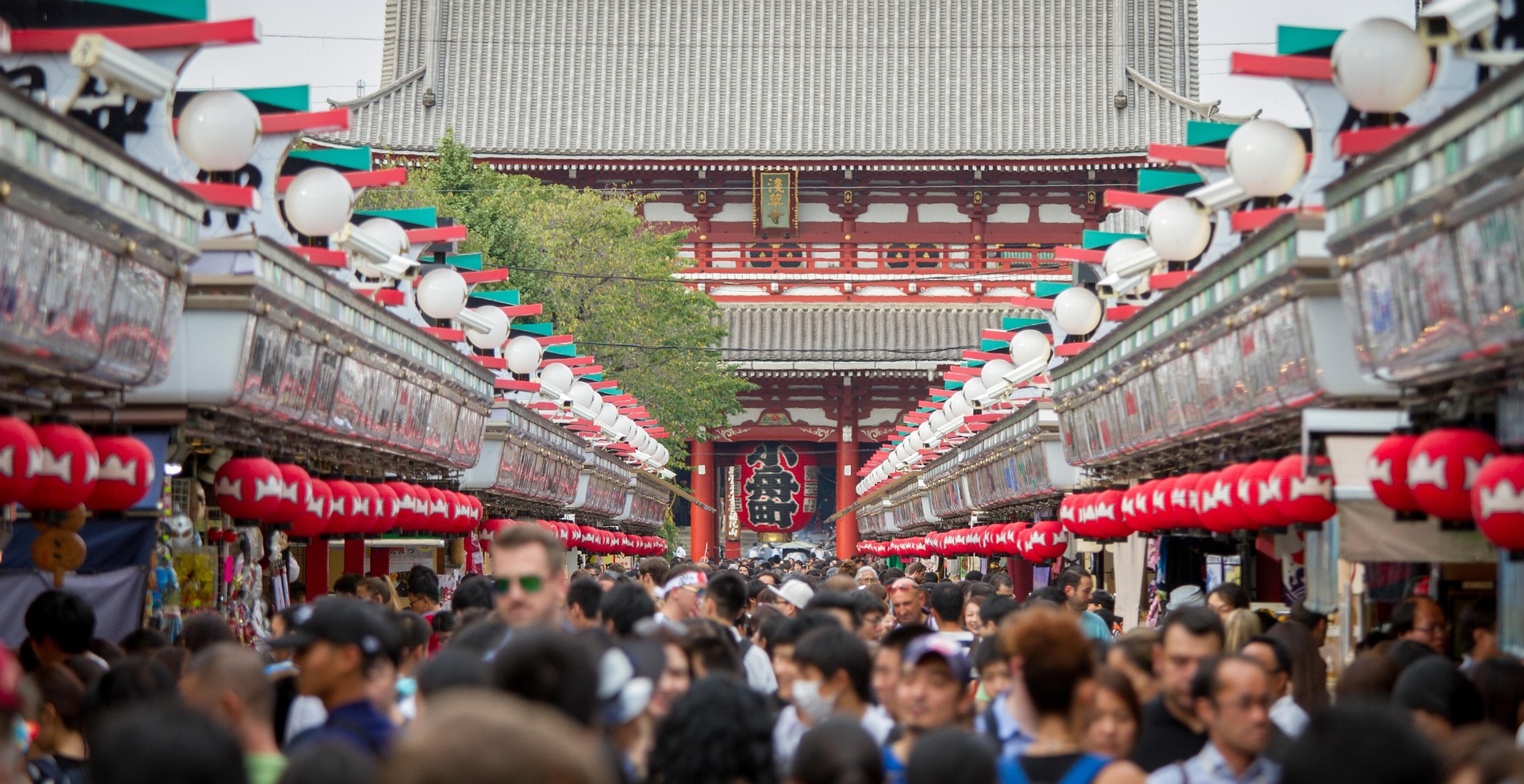
Inside China, people overwhelmingly call it Chang Jiang, which translates to Long River. When you see the phrase chang jiang yangtze river in travel guides, that is simply bridging both names. If you ask directions on the street in Chongqing, Wuhan or Nanjing, say Chang Jiang and you will be understood.
The river also wears other names along the way. In the highlands it is known as the Jinsha, or Golden Sands, a nod to the glinting gravel bars that flash at low water. At Yibin in Sichuan, the Jinsha meets the Min and the main stem takes on the formal Chang Jiang title.
So where is the Yangtze River located?
A quick geography sketch helps:
-
Source area: glaciers and snowfields of the Tibetan Plateau in Qinghai, near the Tanggula and Geladandong ranges
-
General direction: west to east, with large bends through deep gorges and wide basins
-
Mouth: a broad estuary on the East China Sea at Shanghai
Across its course, the yangtze river location intersects or borders 11 provincial-level regions commonly listed as Qinghai, Tibet Autonomous Region, Sichuan, Yunnan, Chongqing, Hubei, Hunan, Jiangxi, Anhui, Jiangsu and Shanghai. Maps vary on the precise boundary sections, since the main channel sometimes forms provincial borders while major lakes and tributaries carry the flow through neighbouring provinces.
Key cities along the main stem include:
-
Yibin and Luzhou in Sichuan
-
Chongqing, a major inland port
-
Yichang and Wuhan in Hubei
-
Jiujiang in Jiangxi, near Poyang Lake
-
Wuhu and Anqing in Anhui
-
Nanjing and Zhenjiang in Jiangsu
-
Shanghai at the river mouth
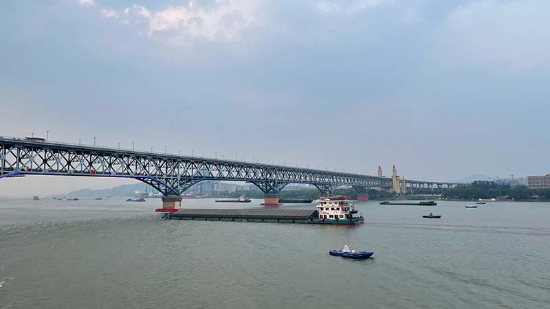
Ask any shipping pilot and they will add dozens more ports and anchorages. The river is busy.
Reading the river on a map
On a map of the yangtze river in china, the line is wide and sinuous, often drawn as the practical dividing line between northern and southern China. It is not a rigid frontier, more a cultural and climatic hinge. Rice-growing plains dominate to the south and east, loess plateau and wheat fields to the north and west. The yangtze river on map images usually show three big geographic chapters that help make sense of the river if you are planning routes with Three Bears Travel or simply building a mental atlas.
-
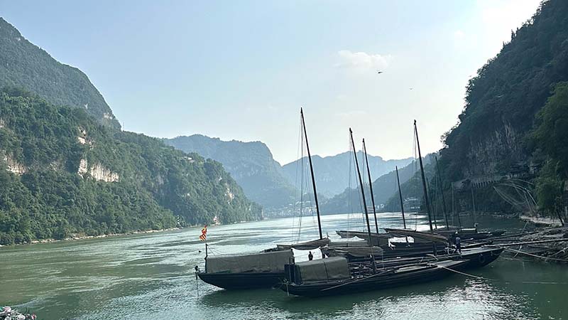
Upper reaches: mountain headwaters and deep canyons, including the famous bends near Shigu and the start of the Three Gorges corridor
-
Middle reaches: lake country around Dongting and Poyang, broad floodplains, and the megapolis of Wuhan
-
Lower reaches: low-gradient plains, levees, polders and the large delta system that hosts Nanjing, Suzhou, Wuxi and Shanghai
If you like coordinates, the source area sits near 33 degrees north, 91 degrees east, and the mouth lies around 31 degrees north, 122 degrees east. That slight southward drift hides a complex pattern of bends and structural faults that guide the water.
A quick table for bearings
|
Reach |
Key provinces or regions |
Signature landscapes |
Major cities |
Travel notes |
|
Upper |
Qinghai, Tibet AR, Sichuan, Yunnan, Chongqing |
Glaciated headwaters, high plateaus, Jinsha canyons, Sichuan Basin rim |
Yushu (region), Yibin, Chongqing |
Clear light, dramatic relief, spring and autumn bring crisp views; access often by air or high-speed rail to Chengdu then road or rail onwards |
|
Middle |
Hubei, Hunan, Jiangxi |
Three Gorges, karst valleys, Dongting and Poyang lakes, vast plains |
Yichang, Jingzhou, Wuhan, Yueyang, Jiujiang |
Classic river cruises run Yichang to Chongqing; lakes teem with birds in winter; humid summers and vivid green rice fields |
|
Lower |
Anhui, Jiangsu, Shanghai |
Lowland levees, canals, lakes and the tidal estuary |
Wuhu, Nanjing, Zhenjiang, Shanghai |
Dense heritage, easy rail links, riverfront promenades; estuary wetlands great for photography and seasonal migration |
The map of the yangtze river china tells you more than a set of lines, it shows how topography, climate and urban investment knit together.
Why the China Yangtze shapes both land and life
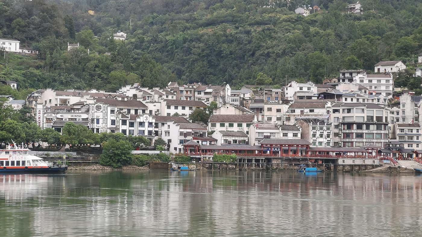
The yangtze river of china is a core artery for agriculture and shipping. The middle and lower reaches host some of the richest farmland on earth, with rice paddies, rapeseed fields and aquaculture ponds tucked behind levees. The delta supports a manufacturing and services belt that links inland cities to global trade.
Water management is the other thread. Floods have always been part of the system. Ancient levees and spillways gave way to modern dams and diversion projects. The Three Gorges Dam near Yichang, one of the largest hydropower stations anywhere, anchors a network that supports electricity generation, flood moderation and year-round navigation depth. There are trade-offs, and the engineering conversation is ongoing, yet the net effect is a safer and more predictable shipping channel from the sea to Chongqing and beyond.
Poets found inspiration in this landscape long before container ships and concrete locks. Li Bai wrote of moonlit sails and wine on the water. Du Fu saw the river as witness to war and rebuilding. Ink painters carved out entire schools of shanshui around towering cliffs and misted pines. Walk the riverside at Nanjing at dusk and the same silhouettes take shape.
How the river is organised by nature and use
One neat way to grasp the yangtze in china is to break down its physical and human systems:
-
Tributaries: the Min, Jialing, Han, Gan and countless smaller rivers feed the main stem. The Han meets the Chang Jiang at Wuhan, a classic river confluence city.
-
Lakes: Dongting in Hunan and Poyang in Jiangxi act as seasonal reservoirs, buffering floods and nurturing fisheries. They also attract massive flocks of migratory birds.
-
Shipping: deep-draught vessels reach Wuhan and, in certain seasons and with works completed, Chongqing. A web of canals connects the river to inland ports.
-
Industry and research: shipbuilding, steel, electronics, agriculture, universities and labs all sit within a few hours of the banks.
-
Culture: temple complexes, old treaty ports, treaty-era architecture in places like Hankou, and museums that trace 5,000 years of water management.
This is why the yangtze river location is central to any study of Chinese economy and society. It links inland provinces to coastal trade and ties mountains to the sea.
A traveller’s guide with Three Bears Travel
If you are planning with Three Bears Travel, here is how to shape a strong itinerary that does the river justice without rushing.
Suggested 7 to 10 day outline:
-
Chongqing to Yichang cruise through the Three Gorges with shore visits to Shibaozhai, Fengdu or White Emperor City
-
Rail to Wuhan for a day on the riverfront and the Yellow Crane Tower
-
Continue by high-speed train to Nanjing for city walls, museums and a sunset ferry crossing
-
Finish in Shanghai with a day on the Bund and a side trip to a canal town on the lower delta
Best seasons:
-
March to May: mild temperatures, flowering rapeseed, good river visibility
-
September to November: stable weather, softer light, lower humidity
-
Summer brings lush green hills but also heat and high rainfall. Winter is quieter, great for birdwatching on the lakes and sharp blue skies after cold fronts.
What to bring:
-
Light layers and a breathable rain jacket
-
Good walking shoes for stone steps at gorge temples
-
Binoculars for cliff swallows, raptors and winter cranes
-
A small dry bag for camera gear during drizzly days
Three Bears Travel can organise cruise segments, rail tickets and local guides who know the smaller riverfront streets. The boat is only part of the story. Time on shore gives the colour.
Ecology, rare species and river health
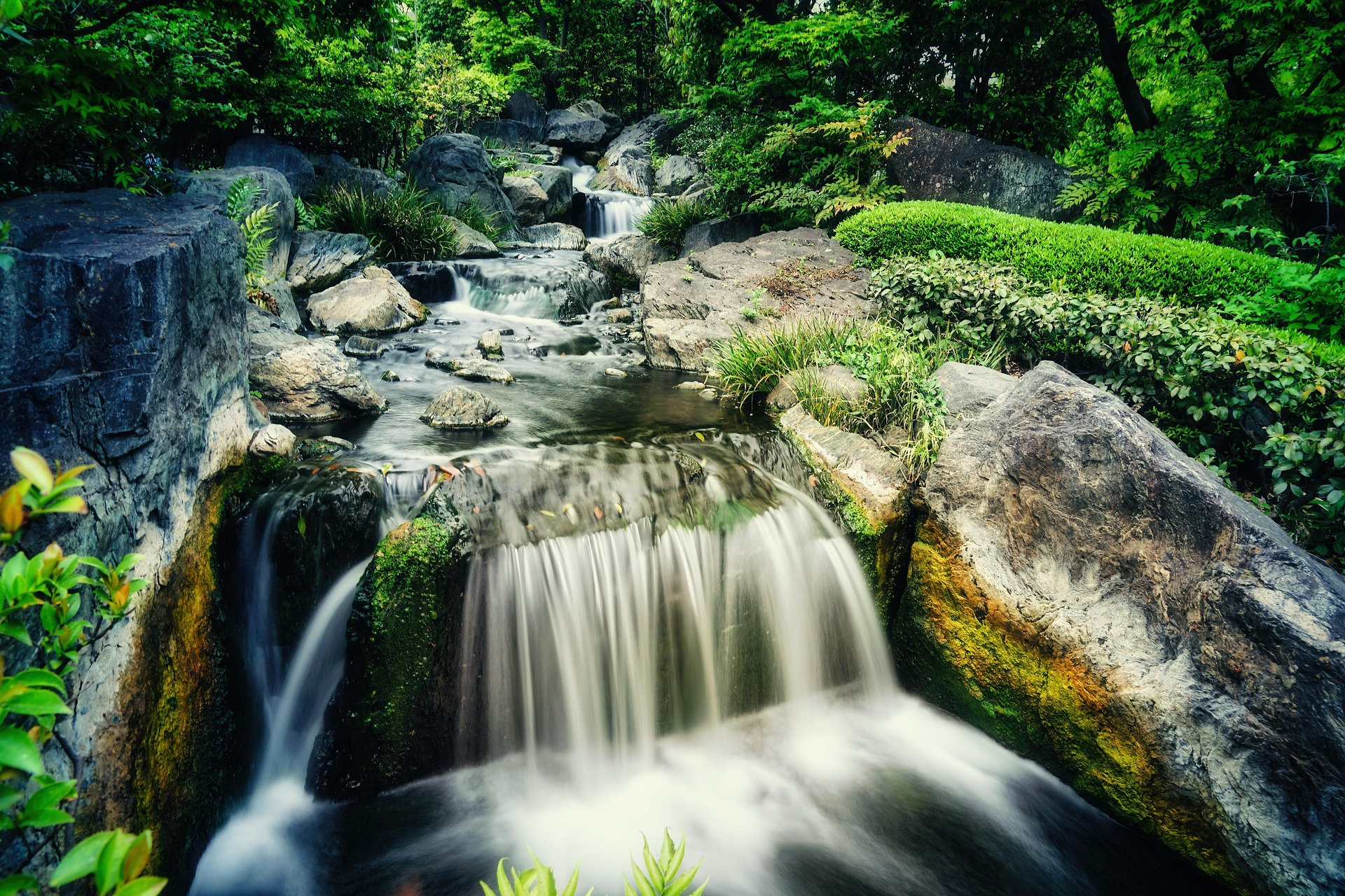
The river holds immense biological value. The basin shelters the Chinese sturgeon, finless porpoise and paddlefish history that now reads as a cautionary tale. Habitat fragmentation and heavy fishing pushed several species to the brink, and one, the baiji dolphin, is considered functionally extinct.
There is good news too. Fishing bans across large stretches of the main stem and key tributaries are in place, running for a decade in many sections. Wetland restoration at Dongting and Poyang is underway. Hydrology data and satellite monitoring now guide seasonal flows and help protect nesting grounds.
If you watch for wildlife:
-
Scan the slick water near Yichang and Wuhan for finless porpoises, especially on calm mornings
-
Visit lake reserves with local wardens who track cranes and geese during the northern winter
-
Photograph with long lenses and keep your distance, since wake and noise can stress animals
Protecting the Yangtze River is not only about rare creatures. Cleaner water means healthier farms, safer cities and more resilient travel experiences over time.
A quick set of facts to anchor your mental map
-
Length: about 6,300 kilometres, making the yangtze river the longest in Asia and in the top three worldwide
-
Basin size: around 1.8 million square kilometres
-
Source area elevation: sources above 4,500 metres, dropping to sea level at the delta
-
Average discharge: roughly 30,000 cubic metres per second near the mouth, with strong seasonal peaks
-
Hydropower: Three Gorges Dam at Sandouping and a chain of upstream stations on the Jinsha and Min
-
Ports: Shanghai, Nanjing, Wuhan and Chongqing rank among the busiest inland and estuarine hubs on earth
-
Heritage: ancient levees, watchtowers, and trading guild halls dot the banks from Sichuan to Jiangsu
Keep these in mind when you look at any map of the yangtze river in china. Numbers give shape to the blue line.
How the river shapes weather, food and daily life
Stand on the Wuhan riverside in late spring. Warm air rises off the water. Ferries push across the channel. Street cooks ladle hot dry noodles, sesame-slick and peppery. The humidity that frustrates photographers brings tea plantations to life in the hills, lush rice terraces to the plains and vast vegetable harvests to city markets.
The lower reaches host a famous cuisine built around freshwater fish, hairy crab in season, lotus root, and soy-based sauces that pair well with river fish. Upstream in Sichuan, spice rules, with hotpots and peppercorns offering a counterpoint to the cool mist that often sits in the valleys. Food maps onto water. That is not poetic license, it’s the way the supply chains and seasons work.
Rivers as transport networks old and new
Before modern rail, the Chang Jiang was the backbone of inland transport. Timber, tea, salt, silk and grain all moved on the current. Today container ships and bulk carriers share space with cruise boats and ferries. Locks at major dams lift ships hundreds of metres over a series of steps, keeping the channel open.
High-speed rail lines now run parallel for long stretches. This twin system, rail plus river, gives travellers flexibility. You can ride a boat through the gorges and then bolt to Nanjing at 300 km/h the next day. Three Bears Travel uses that pairing to fit more into shorter trips without turning every day into a haul.
Using a map to plan a trip
If you are studying a map of the yangtze river china and plotting a route, try this method:
-
Mark the segment you most want to see, for many that is the Three Gorges between Chongqing and Yichang.
-
Add one lake stop, either Dongting near Yueyang or Poyang near Jiujiang, to see the side arms of the system.
-
Choose one heritage city on the lower river, Nanjing is a strong pick for walls, museums and river ferries.
-
End with the delta and the sea, Shanghai gives the sense of river meeting ocean.
The yangtze river on map will also show clusters of canal towns around Suzhou and Wuxi. These are not on the main stem but connect to it, and they make a fine final day.
Safety, etiquette and river sense
Rivers ask for a bit of respect. A few simple habits make travel smoother:
-
Stick to marked river trails and steps, rocks can be slick with algae
-
Wear a life jacket on small boats, even for short hops
-
Ask before photographing people working on the water or at temple sites
-
Keep plastic bags and food wrappers packed away, wind gusts on decks can send them flying
Local guides add context that a signboard cannot, from old guild traditions to flood height markers on bridge piers. They also know when to linger for sunset light and when to move on before the crowds build.
Why maps keep bringing people back
Every time you pull out a new edition of a school atlas or scan a satellite map on your phone, the same shape draws the eye. A long sweep from Tibet to the sea, pinched in the middle by limestone cliffs, spreading wide in a delta of channels and wetlands. The yangtze river location is not just coordinates. It ties mountain monasteries to shipping yards, rice terraces to financial districts, reedbeds to research labs.
For a first-time visitor, that can be the big surprise. One river holds so many worlds. A good itinerary with Three Bears Travel matches that variety, mixing boat time with city walks and quiet hours on lakeshore hides.
You can stand in Shanghai watching the brown-green water push past ocean-going hulls, then a few days later lean over the rail in the Qutang Gorge and listen to the slap of waves against rock older than any dynasty. That is the China Yangtze experience at its best.
FAQ: Discovering the Yangtze River in China
Embark on an enlightening journey as you dive deep into understanding the Yangtze River—China’s monumental waterway. This legendary river is not just a geographical marvel, but a bustling artery of culture, history, and economy.
Where is the Yangtze River located?
The Yangtze River flows for over 6,300 kilometres from the Tibetan Plateau to the East China Sea near Shanghai, traversing 11 provincial-level regions.
Why is the Yangtze River called Chang Jiang locally?
In China, the river is primarily known as Chang Jiang, meaning “Long River,” reflecting its length and historical significance in Chinese culture.
What are the key cities along the Yangtze River?
Major cities along the river include Chongqing, Wuhan, Nanjing, and Shanghai, each offering unique insights into China's diverse landscapes and cultures.
How does the Yangtze River impact China’s economy?
Serving as a crucial trade route, the Yangtze River links inland cities to coastal trade, fuelling economic activities from agriculture to manufacturing.
What is the best way to explore the Yangtze River?
A cruise along the Yangtze, combined with visits to its key cities and cultural sites, provides a comprehensive experience of this essential natural and cultural landmark.
What is the Yangtze River famous for?
The Yangtze River is renowned for its breathtaking scenery, including the dramatic Three Gorges, its role as the cradle of ancient Chinese civilisation, and its importance as the longest river in Asia. It is also famous for the Three Gorges Dam, the world’s largest hydroelectric power station.
Is the Yangtze River safe to swim in?
Swimming in the Yangtze River is generally not recommended due to strong currents, heavy boat traffic, and varying water quality. Local authorities often advise against swimming for safety reasons.
Is the Yangtze River drinkable?
The water from the Yangtze River is not safe to drink without proper treatment. Pollution from industrial and agricultural sources means that the river water must be purified before it is suitable for consumption.
Is the Yangtze River the same as the Yellow River?
No, the Yangtze River and the Yellow River are two distinct rivers in China. The Yangtze is the longest river in China, while the Yellow River, also known as Huang He, is the second longest and is located further north.
Where does the Yangtze River start and end?
The Yangtze River begins in the glaciers of the Tibetan Plateau in Qinghai Province and flows eastward across China, eventually emptying into the East China Sea near Shanghai.
Want more China travel itineraries? Click here!
If you have any other questions, feel free to click here and get in touch with us.
If you need a personalized travel plan, feel free to click here and let us help you.